Lituya Bay

Introduction
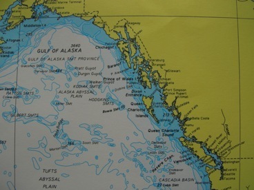

Lituya Bay is located in Alaska on the North Pacific coast.

It backs up against the Fairweather range- a mountain range that rises to a height of 15,298 feet (4,663 meters)
Several glaciers flow into it: Lituya glacier, Cascade glacier and North and South Crillon glaciers.
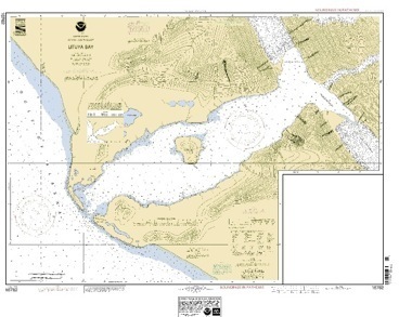
Lituya Bay is shaped like a “T”.
Its upper boundary is located on a geologic fault that is the site of intense seismic activity.
In the center of the bay is the Cenotaphe island, so named by Laperouse in memory of his twenty-one lost sailors.
The entrance to the bay is partially blocked by a rock formation called “La Chaussee”.


During the Ice Age, the sea level was considerable lower than it is today. At the time, the glaciers flowed onto the continental shelf itself. The melting of the glaciers caused oceans levels to rise. Lituya Bay is the site where one of those ancient glaciers has long since disappeared.
“La Chaussee” is what remains of a terminal moraine, corresponding to what was the front of the glacier at a period when the glacier was slowing down as it melted.
Violent currents, whirlpools and very strong waves can spring to life, especially at ebb tide when combined with a strong southwest sea swell.
Despite these dangers, Lituya Bay is one of the only natural shelters along the coast between Cape Spencer and Yakutat Bay for small vessels during bad weather.